Cartography & GIS
Environmental mapping and GIS
Cadrey maps habitats and turns field data into usable maps and atlases: to understand a habitat, prepare fieldwork and pass data on.
- Your needs
- Understand or present a habitat, prepare field surveys, make layers usable.
- What you receive
- A summary map, an atlas or field sheets.
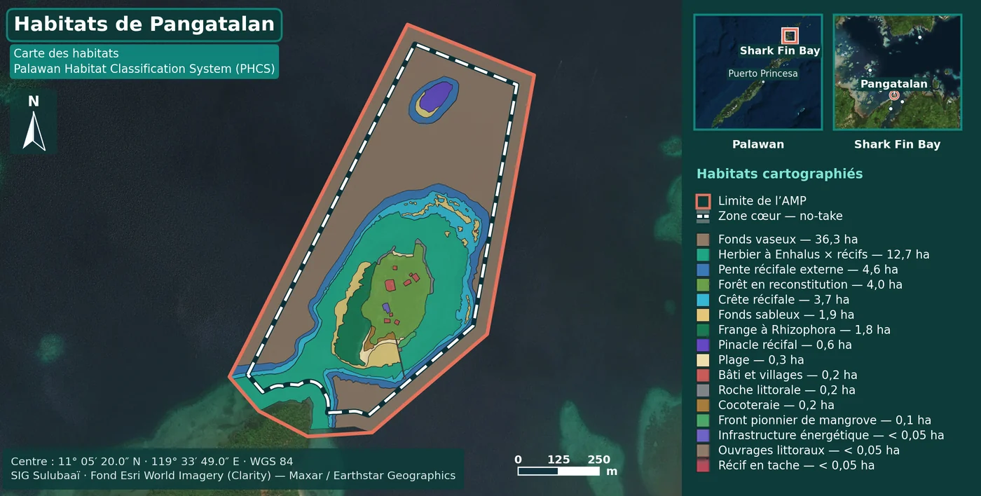
Sulubaaï: eight marine habitat maps
- The need
- Give each marine protected area of the Sulubaaï programme a habitat map that can be read in its factsheet.
- Work shown
- Digitising the habitat polygons, the PHCS typology and the cartography of the eight sheets. Data and surveys are collective.
- The decision that changes the use
- The legend gives the area of each habitat: the map can be read without the report beside it.
Montagne Noire: from the massif to the plot
Forest atlas of the Montagne Noire: one overview locates the 32 survey plots, then the QGIS atlas gives each plot its own field sheet. A collective teaching project at EGPN.
See the forest atlasCadrey also builds business and event websites