
Cadrey Web design & cartography

Your idea deserves to see the light.

Cadrey designs bespoke business and event websites for freelancers, small businesses and non-profits, and maps for people who work for the environment.

See a website take shape

Cadrey demo · Fictional studio

A website for Sillon’s ceramics studio

Sillon

Pieces to live with, thrown one by one.

Stoneware bowls, cups and plates, shaped and glazed in the studio. Come and see them, or throw your own.

Two hands shape a bowl on a potter's wheel
Next workshop Saturday morning, 4 places
  • Glazed stoneware
  • Fired at 1,280 °C
  • Dishwasher safe

Three questions behind the homepage

  1. What do you want people to discover?The craft. A photo of hands throwing a bowl opens the page.
  2. What feels like you?An understated serif headline and a touch of glaze yellow.
  3. What should visitors be able to do?Book a workshop. A button opens the booking demo.

Web design

Business and event websites, clear from the first screen.

Show what you do, take bookings or make an event programme easy to find. Cadrey builds your website around what visitors need to do, on phones too.

What you receive

A website ready to publish, and guidance on updating the content we agree should be editable.

Selected work

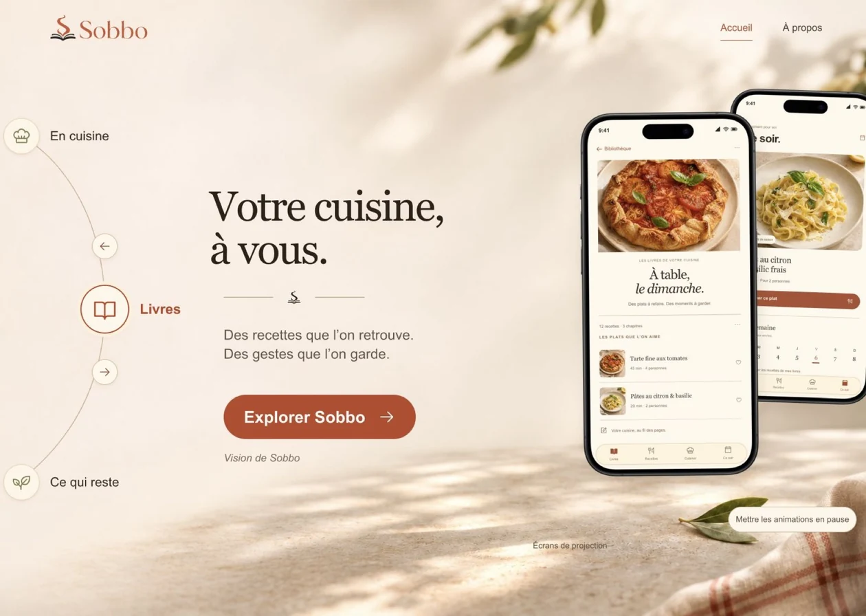
iOS app and its website

Sobbo

A website for an app that turns recipes into cookbooks.

On the website, a wheel lets visitors discover what the app can do, one feature at a time.

iOS app in development.

Sobbo presentation website

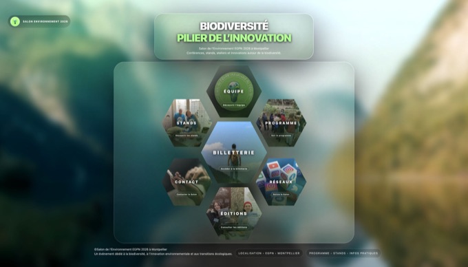
Event website · Montpellier

Salon de l’environnement

Find your way around the event, then explore each exhibitor without leaving the stands list.

Read the case study

Scroll to read the project, or press Escape to return to the same place.

Cartography & GIS: a place, a thousand things to understand

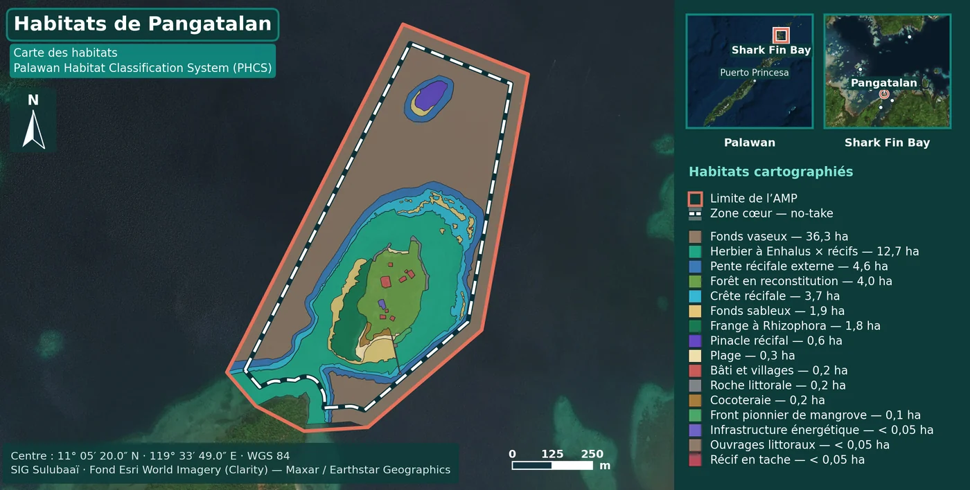
From Montpellier, home of the Salon de l’environnement, to Pangatalan in Palawan, where marine habitats were mapped for the Sulubaaï programme.
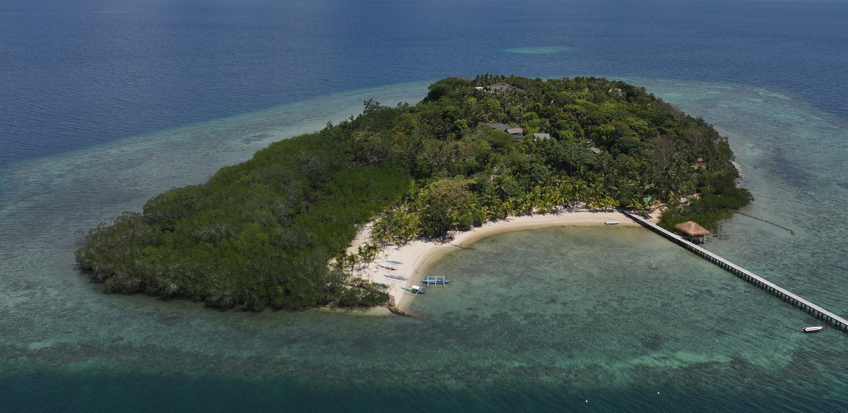
Aerial view of Pangatalan island, its forest, beach and reef
Pangatalan, PalawanPhotograph: Sulubaaï · 13 April 2026
Sulubaaï · a real project

See a living place.

Cadrey maps habitats and turns field data into usable maps and atlases.

Sulubaaï · Marine habitats · Final maps
1 / 8

Final Pangatalan habitat map with legend, scale and credits

Sheet legend

    Areas are those printed on the final map. Highlights follow the shapes of the sheet itself.

    Habitat mapping for the Sulubaaï programme. Collective data and surveys. Original legends, scales and basemap credits preserved on each sheet.

    Habitat mapping for the Sulubaaï programme. Collective data and surveys. Original legends, scales and basemap credits preserved on each sheet.

    Cartography & GIS

    Maps people can read, and layers people can use.

    From field data to a clear, readable map.

    • Understand or present a habitat
    • Prepare field surveys
    • Make layers usable

    What you receive Summary map · Atlas · Field sheets

    The need
    Give each marine protected area of the Sulubaaï programme a habitat map that can be read in its factsheet.
    Work shown
    Digitising the habitat polygons, the PHCS typology and the cartography of the eight sheets. Data and surveys are collective.
    The decision that changes the use
    The legend gives the area of each habitat: the map can be read without the report beside it.
    What you can look at
    Eight final maps from the programme’s MPA factsheets, Pangatalan first.

    Pangatalan

    Original ↗

    Pangatalan habitat map including legend and credits

    Use zoom, then scroll to inspect. The image retains its original legend and credits.

    GIS · Forest inventory

    From the massif to the plot.

    Forest atlas of the Montagne Noire: one overview locates the 32 survey plots, then the QGIS atlas gives each plot its own field sheet.

    The need
    Read forest types across the massif and find each survey plot in the field.
    Work shown
    The cartography: forest types over relief, and the atlas that produces the sheets. Academic group project at EGPN.
    What you can look at
    The overview and the BEECH-07 plot sheet. Data and imagery credits are on the sheets.
    Discuss your mapping project
    Montagne Noire map showing forest types over shaded relief and an inset locating 32 plots Sheet for plot BEECH-07, with aerial view, locator map and site characteristics

    Open the map sheet ↗

    A first conversation

    Let’s talk about your idea.

    A vague idea is enough to start.

    Sillon · Demo booking

    Three ways to get your hands in the clay

    Duration
    Group
    You leave with

    Sillon is fictional. Pottery photograph from Unsplash.